Integrated Development Planning
Overview
Job Growth
N/A
Duration
N/A
Avg. Salary
N/A
Career Paths
N/A
Program Description
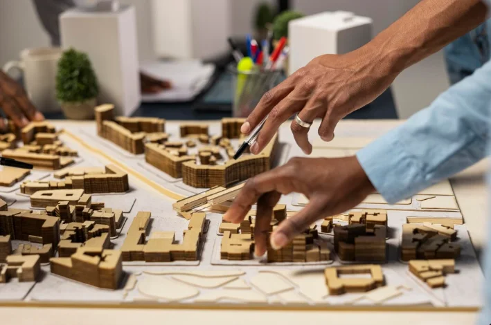
Integrated Development Planning teaches how to design, organize, and manage physical spaces, towns, and infrastructure so communities work well and grow sustainably. Students learn site analysis, land use planning, surveying, basic design and drawing, geographic information systems, project management, and environmental impact assessment. Main subjects include urban planning, mapping and GIS, technical drawing and CAD, construction basics, and environmental planning. Graduates can work as urban planners, architects, construction managers, surveyors, or environmental consultants in local government, private firms, and NGOs. This program builds practical skills that let you shape better neighborhoods and infrastructure, and it opens clear career paths in Ghana and beyond.
Aims & Objectives
Develop the ability to analyse sites and produce clear site plans and land use maps using basic GIS and mapping tools.
Master technical drawing and Computer Aided Design (CAD) to create accurate layout and design drawings.
Understand and apply building codes, land use policies, and environmental impact assessment principles in planning decisions.
Create and manage simple development projects, including preparing project briefs, basic cost estimates, and timelines.
Why Choose This Program?
High demand from growing towns
Ghana's rapid urbanisation increases need for planners and construction managers to design roads, housing, and services.
Hands-on practical training
Coursework includes field surveys, site analysis and real planning tasks that prepare you for work placement and entry-level jobs.
Clear career pathways
Leads to careers in government assemblies, architectural and engineering firms, construction companies, and environmental consultancies.
Focus on sustainability and resilience
You learn sustainable design and climate-aware planning, skills that are increasingly valued in public and private projects.
Skills & Tools
Skills You'll Develop
Use AutoCAD or similar tools to create accurate site plans, floor plans, and technical drawings for projects.
Apply QGIS or ArcGIS to map land use, analyse spatial data, and support planning decisions.
Understand BIM principles and use entry-level tools like Revit to coordinate design information and reduce errors.
Carry out basic surveys, measure sites with GPS or total station data, and interpret topography for planning.
Tools & Resources
AutoCAD
Revit or other BIM tools
QGIS or ArcGIS
Microsoft Project or similar scheduling tools
Challenges & Tips
Challenges
Strong maths and spatial thinking required
Learning complex software can be overwhelming
Understanding regulations and policy details
Tips & Advice
Practice algebra, geometry and technical drawing early, and use online tutorials to strengthen weak areas.
Start with basic functions, follow step-by-step tutorials, and practise on small projects regularly.
Study local planning bylaws gradually and ask teachers or professionals for practical examples and clarifications.
Video Guide
Frequently Asked Questions
Ready to Apply?
Find programs that match your grades and interests - even if you haven't written WASSCE yet
Loading.. Please wait.

Talk to a Professional
Join a mentorship session with real professionals working in your field of interest.
Advertisement