Geological Engineering
Overview
Job Growth
N/A
Duration
N/A
Avg. Salary
N/A
Career Paths
N/A
Program Description
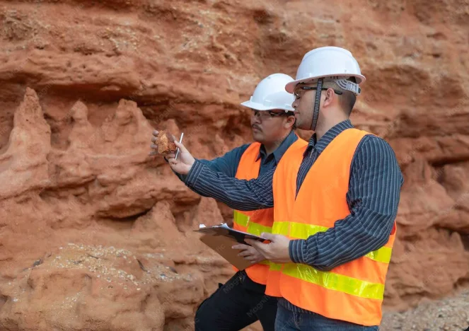
Geological Engineering teaches you how to study Earth materials (soil, rock, groundwater) and use that knowledge to design safe foundations, slopes, tunnels, and resource extraction. You will study geology, soil and rock mechanics, mathematics, physics, surveying, CAD and basic programming for modelling. The course combines classroom theory with fieldwork and lab tests so you learn practical techniques used on construction sites, mines and oil projects. Graduates can work as geotechnical or civil engineers, site investigation specialists, mining and petroleum engineers, environmental consultants, or move into research and project management. If you enjoy science, maths and outdoor fieldwork, this programme opens many job opportunities in Ghana’s growing infrastructure, mining and energy sectors.
Aims & Objectives
Develop the ability to plan and carry out site investigations and interpret geological and geotechnical data.
Master use of industry software (AutoCAD, MATLAB) and measurement tools to model and design infrastructure.
Understand and apply soil and rock mechanics to design safe foundations, slopes and underground works.
Create clear technical reports, maps and drawings that meet professional and regulatory standards.
Apply health, safety and environmental practices in fieldwork and engineering projects.
Why Choose This Program?
High demand in Ghana
Strong need for geotechnical expertise in construction, mining and oil & gas means steady local job opportunities.
Hands-on field experience
Regular fieldwork and lab tests teach practical skills employers value from day one.
Multiple career pathways
Pathways include civil engineering, mining, environmental consulting, petroleum and project management.
Industry links and internships
Programs often connect students with construction firms, mines and oil companies for placements.
Impactful, real-world work
You help design safe infrastructure, reduce disaster risk and manage natural resources for society’s benefit.
Skills & Tools
Skills You'll Develop
Plan and perform field sampling, boreholes and lab tests to assess soil and rock properties.
Use AutoCAD to create site plans, cross-sections and engineering drawings for construction projects.
Apply maths and MATLAB to model groundwater flow, slope stability and foundation behavior.
Use total stations, GPS and GIS tools to map sites accurately and integrate data for designs.
Prepare clear, standard-compliant reports, risk assessments and technical specifications.
Tools & Resources
AutoCAD
MATLAB
Visual Studio Code
Microsoft Project
Challenges & Tips
Challenges
Difficult maths and mechanics topics
Complex laboratory procedures
Integrating field and theory
Tips & Advice
Build a strong foundation in algebra, calculus and physics; use online courses and practice problems weekly.
Attend lab sessions actively, take detailed notes and review procedures before practicals to reduce mistakes.
Connect classroom concepts to field examples; write short field reports that link measurements to theory.
Video Guide
Frequently Asked Questions
Ready to Apply?
Find programs that match your grades and interests - even if you haven't written WASSCE yet
Loading.. Please wait.

Talk to a Professional
Join a mentorship session with real professionals working in your field of interest.
Advertisement