Geoinformation Science
Overview
Job Growth
N/A
Duration
N/A
Avg. Salary
N/A
Career Paths
N/A
Program Description
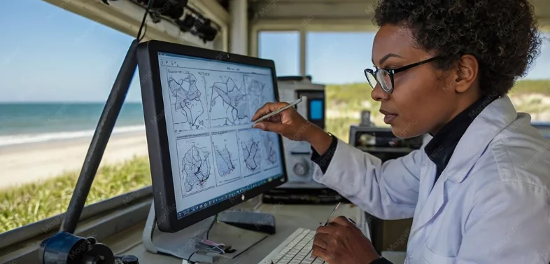
Geoinformation Science teaches how to collect, analyze, and use location data to solve real-world problems. You will study map-making, geographic information systems, remote sensing, survey methods, spatial databases, and basic programming for spatial analysis. The program trains you to design and manage geospatial systems used in urban planning, infrastructure, agriculture, mining, disaster risk management, and environmental monitoring. Graduates find roles as GIS technicians, surveyors, geospatial analysts, or support positions in civil engineering, government planning, and NGOs. If you enjoy maps, technology, and solving practical problems, this program opens doors to steady, in-demand careers that help shape Ghana's development.
Aims & Objectives
Develop practical skills in GIS software to create, edit, and analyze digital maps and spatial data, demonstrated by completed mapping projects.
Master remote sensing interpretation and image processing to extract land use and environmental information from satellite or drone imagery.
Understand and apply GNSS and conventional surveying techniques to collect accurate field position data with measurable accuracy.
Create and manage spatial databases using standard formats and SQL for efficient storage and retrieval of geospatial data.
Why Choose This Program?
High demand across sectors
Geospatial skills are needed by government, engineering firms, agriculture, mining, and NGOs, creating broad job opportunities in Ghana.
Practical, hands-on learning
Coursework combines classroom theory, field surveys, and lab-based GIS projects so you build useful, employable skills.
Supports national development
Work in infrastructure planning, natural resource management, and disaster response, contributing directly to Ghana's growth.
Internship and industry links
Students can access placements with surveying firms, municipal planning departments, and environmental NGOs for real-world experience.
Skills & Tools
Skills You'll Develop
Build, visualize, and analyze maps and spatial data for planning, asset management, and decision making.
Process satellite and drone imagery to detect land cover, monitor crops, and assess environmental change.
Use GPS receivers and conventional survey tools to capture accurate location coordinates for mapping and construction.
Organize and query geospatial datasets to support reporting, mapping, and system integration.
Tools & Resources
QGIS
ArcGIS Pro
Google Earth Engine
Challenges & Tips
Challenges
Steep learning curve for math and programming
Tips & Advice
Practice regularly, use step-by-step tutorials, and join study groups or tutoring sessions.
Video Guide
Frequently Asked Questions
Ready to Apply?
Find programs that match your grades and interests - even if you haven't written WASSCE yet
Loading.. Please wait.

Talk to a Professional
Join a mentorship session with real professionals working in your field of interest.
Advertisement